Drone mapping, satellite crop monitoring and spraying across Ghana
Wonfliki is an Accra-based agri-tech company. We map farms with drones, monitor crops from satellite and turn both into maps, registers and advice that farm managers, programmes and buyers can act on.
6 regionsAshanti, Eastern, Central, Bono East, Greater Accra, Volta
UK CAAcertified RPAS (drone) licenceGCAAcertified
3,365 haflagship client estate, Volta Region
Projects
A selection of projects. Client names and survey details are withheld unless the client has agreed; select a project to see more.
Flagship site
Flagship client estate: mapping, monitoring and spraying
Volta Region · about 3,365 ha across two sites
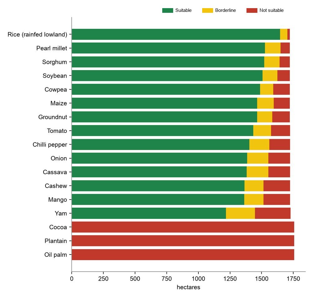
Our largest site and the one where we work across every service. Sagasu, our satellite analysis system, screened 17 crops on a 1,758 ha site and flagged 33 ha of existing tree cover to keep out of new planting.
MappingMonitoringLand suitabilitySpraying
Research partnership · 2024
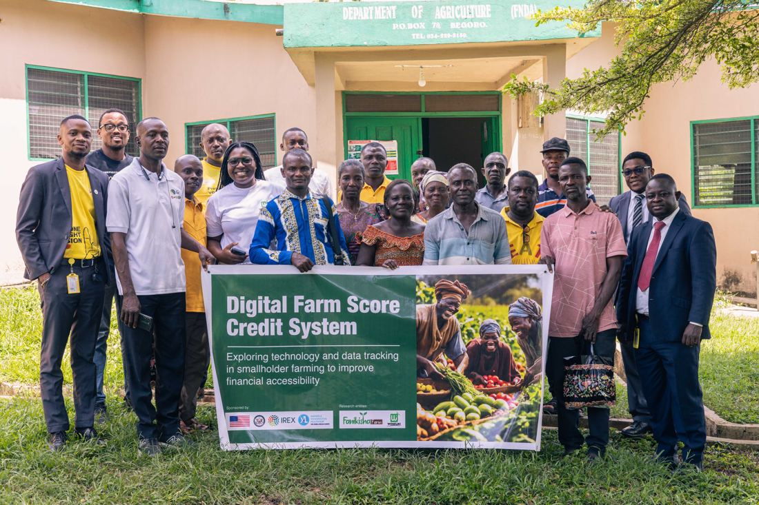
Digital farm credit score for smallholder farmers (LINC)
Begoro, Fanteakwa · Eastern Region
A four-week project with Kenyan start-up Fanikisha Farm, funded by a Mandela Washington Fellowship LINC grant. We combined farm records with satellite crop monitoring to lay the groundwork for a credit score that helps lenders back smallholder vegetable farmers.
MonitoringAgri-finance
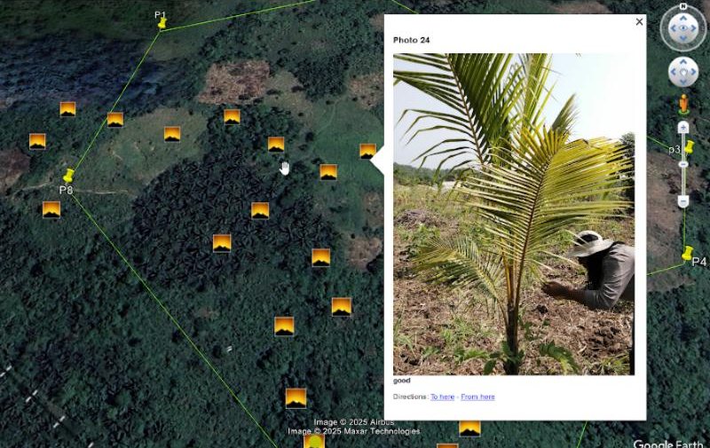
Orthomosaic and tree geotagging
Faaman
Drone orthomosaic and 3D view of the farm, with each coconut tree photographed and geotagged so its condition can be checked on the map.
Mapping
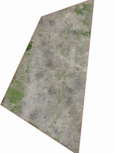
Orthophoto and topographic survey
Commercial client · Greater Accra Region
Georeferenced orthophoto and topographic map with 1 m contours, spot heights and the proposed access road.
Mapping
Drone spraying
Amantin, Bono East Region
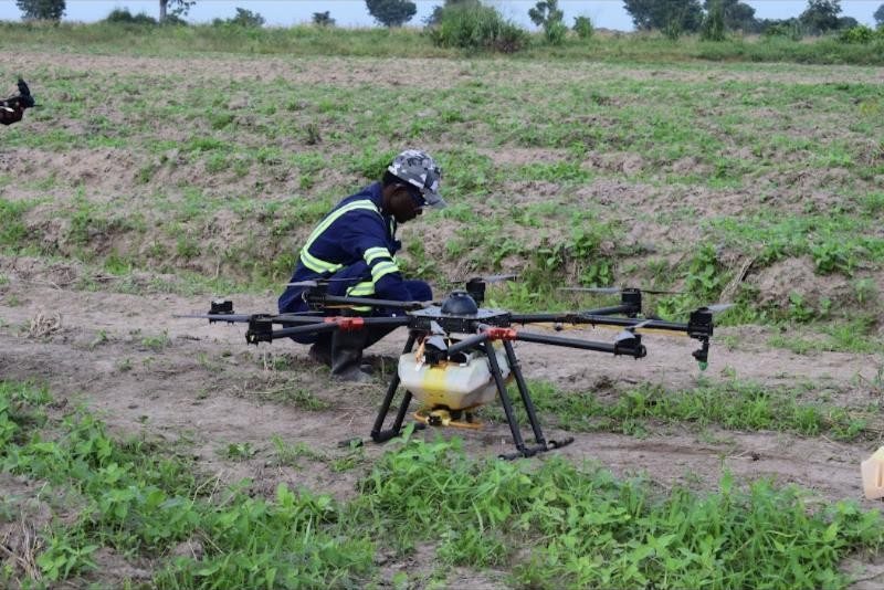
Field team preparing a spray drone for an application. Chemicals are supplied by the client; we plan the flight and apply.
Spraying
Fall armyworm and weed control in maize
Somanya, Yilo Krobo · Eastern Region
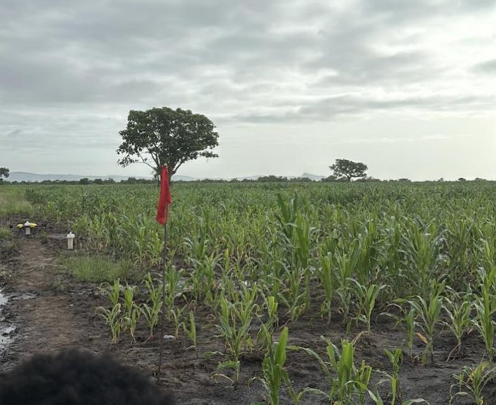
Field marked out and mapped ahead of a drone application against fall armyworm and weeds.
SprayingMapping
Aerial land assessment
Agona Swedru, Central Region
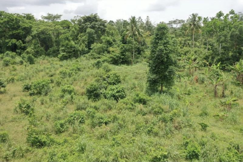
Drone survey of land to show vegetation, terrain and access before the client committed to development.
MappingLand suitability
Aerial scouting
Coastal site · December 2021
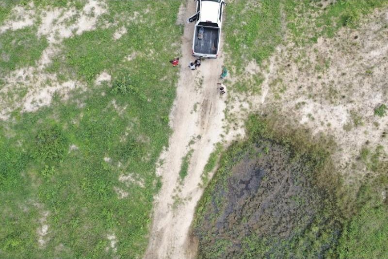
Top-down drone scouting of a site to locate wet ground, access tracks and areas for the ground team to check.
Mapping
Sagasu: our in-house crop monitoring system
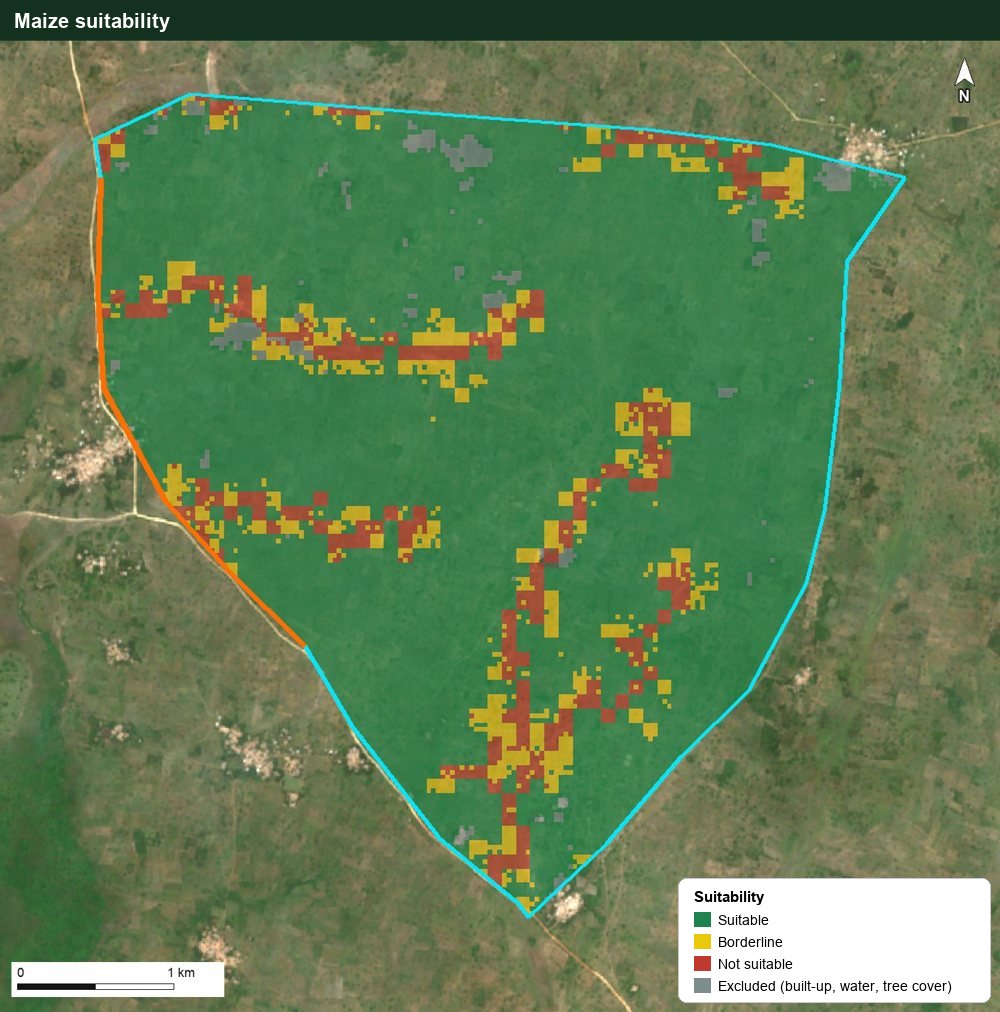
We use an in-house system, Sagasu, to monitor crop suitability and field conditions, with forecasts. It combines satellite imagery with soil, terrain, water and climate data to answer three questions: what can this land grow, how is the crop doing this season, and what is likely ahead? These are its suitability outputs for one 1,758 ha site on our flagship client estate.
Maize suitability across the site: green suitable, yellow borderline, red not suitable, grey excluded (built-up, tree cover, water).Suitability of 17 crops on the same site, in hectares.
Crop
Suitable
Borderline
Not suitable
Maize
1,464 ha
131 ha
127 ha
Cashew
1,364 ha
151 ha
210 ha
Mango
1,362 ha
152 ha
211 ha
Oil palm, cocoa
0 ha
0 ha
whole site
In-season, Sagasu checks fields every few days and flags water stress, waterlogging, possible nutrient deficiency and sudden decline, with GPS points that send scouts straight to the problem. It also gives a forecast of the season ahead, so decisions can be made early. Field teams know exactly where to go and what to look for.
What we do
Service
What you get
Farm boundary mapping
Each farm as a polygon with its area, linked to a farm register.
Orthophoto and topographic mapping
High-resolution aerial maps, contours and spot heights (drone and GIS processing).
Traceability
Plot geolocation and deforestation-risk screening for export buyers.
Land suitability
Which crops a site can support, where, and across how many hectares.
Crop monitoring
Crop suitability and condition monitoring with forecasts, using our in-house system, plus scouting points.
Spraying
Targeted drone application through our team and trusted partners.
Delivered in formats everyone can use
Print-ready maps (PDF and images): no special software needed.
Google Earth files (KML) that open on any phone or laptop.
GIS files (GeoTIFF imagery, shapefiles) for technical teams.
Farm registers (Excel/CSV): one row per farm with ID, crop, area and coordinates.